
Features WaterDataRocks
WaterDataRocks facilitates the simple monitoring and comprehensive data recording of water point information and groundwater levels around the world.
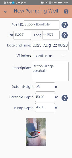
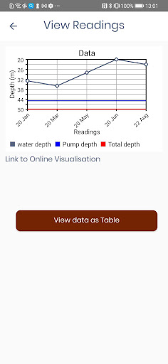
The app is designed to be used alongside an Online Dashboard for data viewing, available at: http://apptest.waterdatarocks.org/public/Key water point information such as ID, GPS location, supply type, basic construction details and water levels can be recorded for each locality, with collected data viewed graphically either online or in the app, allowing for water levels to be compared with total borehole depth and pump installation depths.Technical data collected in the field is directly transferred to an online cloud database, which feeds into country archives, improving groundwater understanding and supporting decision making and operational management of water infrastructure and resources.Available in English, French and Bengali language, for use online or offline.
Fitness Tracking
Track your workouts and monitor your health metrics.
Travel Features
Plan and manage your travels with ease.
News & Updates
Stay informed with the latest news and updates.
See the WaterDataRocks in Action
Get the App Today
Available for Android 8.0 and above